You are using an out of date browser. It may not display this or other websites correctly.
You should upgrade or use an alternative browser.
You should upgrade or use an alternative browser.
Post your hometown's wikipedia page
- Thread starter jimmychung
- Start date
miroz
Active member
Liam.
Active member
killabees
Active member
Hopkinton, Massachusetts
From Wikipedia, the free encyclopedia
Jump to: navigation, search
‹ The template below (Expand) is being considered for deletion. See templates for deletion to help reach a consensus. ›

Please help improve this article or section by expanding it.
Further information might be found on the talk page or at requests for expansion.
This article has been tagged since March 2007.
Hopkinton, Massachusetts

Seal

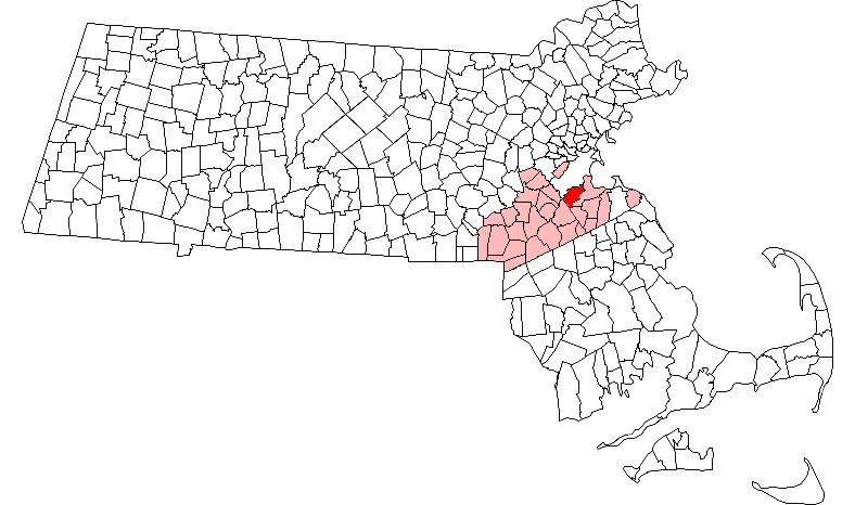
Location in Massachusetts
Coordinates: 42°13′43″N 71°31′23″W / 42.22861, -71.52306
CountryUnited States
StateMassachusetts
CountyMiddlesex County
Settled1715
Incorporated1715
Government
- TypeOpen town meeting
- Town
ManagerAnthony Troiano
- Board of
SelectmenMuriel E. Kramer, Chair
Mary C. Pratt, Vice Chair
Leonard A. Holden
Ronald M. Clark
Michael Shepard
Area
- Town 28.2 sq mi (72.9 km²)
- Land 26.6 sq mi (68.8 km²)
- Water 1.6 sq mi (4.2 km²)
Elevation 410 ft (125 m)
Population (2000)
- Town13,346
- Density502.5/sq mi (194.0/km²)
Time zoneEastern (UTC-5)
- Summer (DST)Eastern (UTC-4)
ZIP code01748
01784
(Woodville P.O. Boxes)
Area code(s)508 / 774
Website: http://www.hopkinton.org/
Hopkinton is a town located in southwestern Middlesex County, Massachusetts, about 40 km (26.4 mi) from Boston. It is one of nine towns that are part of the region known as MetroWest. The population was 13,346 at the 2000 census.
Hopkinton is best known as the starting point of the Boston Marathon, held annually on Patriot's Day in April, and as the home of computer storage firm EMC Corporation.
For geographic and demographic information on the census-designated place Hopkinton, please see the article Hopkinton (CDP), Massachusetts.
Contents
[hide]
[edit] History

This section stub requires expansion.
The Town of Hopkinton was incorporated in 1715.
In February 2006, the town gained international attention from the murders of Rachel and Lillian Entwistle, committed allegedly by Lillian's father Neil Entwistle.
[edit] Hopkinton Historical Commission
The Town of Hopkinton established a historical commission which manages “the preservation, protection and development of the historical or archeological assets of such city or town”. Projects include conducting research for places of historic or archeological value, assisting cooperatively with others engaged in such research, and carrying out other initiatives for the purpose of protecting and preserving such places.
The Commission may have a minimum of three (3) and a maximum of seven (7) members, appointed for staggered three (3) year terms.[1]
[edit] National Register of Historic Places
Hopkinton has two properties in the register.[2]
[edit] Woodville Historic District
This section stub requires expansion.
[edit] Geography
According to the United States Census Bureau, the town has a total area of 72.9 km² (28.2 mi²). 68.8 km² (26.6 mi²) of it is land and 4.2 km² (1.6 mi²) of it (5.82%) is water. Density: 346 per sq. mile.
Hopkinton is 17 miles east of Worcester, 26 miles west of Boston, and 195 miles from New York City.
[edit] Adjacent towns
Hopkinton is located in Eastern Massachusetts, bordered by six towns:
[edit] Climate
Hopkinton, MA climate is mild during summer when temperatures tend to be in the 70's and 80's and very cold during winter when temperatures tend to be in the 20's.
The warmest month of the year is July with an average maximum temperature of 79.30 degrees Fahrenheit, while the coldest month of the year is January with an average minimum temperature of 15.80 degrees Fahrenheit.
Temperature variations between night and day tend to be fairly limited during summer with a difference that can reach 18 degrees Fahrenheit, and fairly limited during winter with an average difference of 16 degrees Fahrenheit.
The annual average precipitation at Hopkinton is 51.25 Inches. Rainfall in is fairly evenly distributed throughout the year. The wettest month of the year is November with an average rainfall of 4.69 Inches.[1]
[edit] Demographics
As of the census2 of 2000, there were 13,346 people, 4,444 households, and 3,621 families residing in the town. The 2005 population estimate for[4] is 14,112. The population density was 194.0/km² (502.5/mi²). There were 4,548 housing units at an average density of 66.1/km² (171.2/mi²). The racial makeup of the town was 96.33% White, 0.69% Black or African American, 0.15% Native American, 1.66% Asian, 0.04% Pacific Islander, 0.29% from other races, and 0.84% from two or more races. Hispanic or Latino of any race were 1.33% of the population.
There were 4,444 households out of which 49.7% had children under the age of 18 living with them, 73.4% were married couples living together, 6.1% had a female householder with no husband present, and 18.5% were non-families. 15.2% of all households were made up of individuals and 5.4% had someone living alone who was 65 years of age or older. The average household size was 2.97 and the average family size was 3.33.
In the town the population was spread out with 33.1% under the age of 18, 3.4% from 18 to 24, 34.0% from 25 to 44, 22.6% from 45 to 64, and 6.9% who were 65 years of age or older. The median age was 36 years. For every 100 females there were 97.4 males. For every 100 females age 18 and over, there were 92.9 males.
The median income for a household in the town was $89,281, and the median income for a family was $102,550. Males had a median income of $71,207 versus $42,360 for females. The per capita income for the town was $41,469. About 1.3% of families and 1.7% of the population were below the poverty line, including 1.4% of those under age 18 and 3.4% of those age 65 or over.
[edit] Government
Since its incorporation in 1715, Hopkinton had retained its original open town meeting form of government and the town's day-to-day affairs were overseen by an elected board of selectmen. However, in 2007, the Town of Hopkinton's Charter Commission created a new town manager position, and hired Anthony Troiano as the first to fill that role.[5]
Since Proposition 2½ limited property tax increases to 2.5% per year, the town has had to ask residents for a number of overrides to maintain funding for certain programs, with school programs heading the list.
[edit] Town Meeting
[edit] Warrant
The Town Meeting Warrant is a document comprised of the articles to be voted on. Any elected or appointed board, committee, town officer or ten voters, may request that an article be included on the warrant. Each article to be voted on is directed by the Board of Selectmen to an appropriate board or committee to hear and provide the original motion at Town Meeting. All articles which require expending of funds are directed to the Finance Committee; articles dealing with planning and zoning to the Planning Board; articles relating to by-laws to the By-Law Committee, and so forth.
[edit] County Government
Massachusetts has 14 counties which were regional administative districts before the Revolutionary War.[6] In 1997, the county governments of Middlesex, Berkshire, Essex, Hampden and Worcester were abolished. Their functions were turned over to state agencies.
Its county seats are Cambridge and Lowell.
Sunset Beach, North Carolina
From Wikipedia, the free encyclopedia
Jump to: navigation, search
Sunset Beach is a town in Brunswick County, North Carolina, United States. The population was 1,824 at the 2000 census.
Contents
[hide]
[edit] Geography

Sunset Beach is located at 33°53′7″N, 78°30′27″W (33.885348, -78.507528)GR1.
According to the United States Census Bureau, the town has a total area of 14.9 km² (5.8 mi²). 13.1 km² (5.1 mi²) of it is land and 1.8 km² (0.7 mi²) of it (12.31%) is water.
[edit] Demographics
As of the censusGR2 of 2000, there were 1,824 people, 909 households, and 678 families residing in the town. The population density was 139.5/km² (360.9/mi²). There were 2,983 housing units at an average density of 228.1/km² (590.3/mi²). The racial makeup of the town was 97.37% White, 0.49% African American, 0.38% Native American, 0.38% Asian, 0.27% from other races, and 1.10% from two or more races. Hispanic or Latino of any race were 1.37% of the population.
There were 909 households out of which 7.6% had children under the age of 18 living with them, 70.0% were married couples living together, 3.3% had a female householder with no husband present, and 25.4% were non-families. 21.3% of all households were made up of individuals and 9.2% had someone living alone who was 65 years of age or older. The average household size was 2.01 and the average family size was 2.28.
In the town the population was spread out with 6.9% under the age of 18, 2.7% from 18 to 24, 12.1% from 25 to 44, 43.6% from 45 to 64, and 34.7% who were 65 years of age or older. The median age was 60 years. For every 100 females there were 97.2 males. For every 100 females age 18 and over, there were 95.2 males.
The median income for a household in the town was $47,356, and the median income for a family was $57,019. Males had a median income of $40,795 versus $27,708 for females. The per capita income for the town was $36,181. About 3.0% of families and 4.2% of the population were below the poverty line, including 3.5% of those under age 18 and 3.2% of those age 65 or over.
[edit] Sunset Beach Bridge
Since most of Sunset Beach and the adjoining Bird Island coastal reserve encompass a barrier island, the only way to get there from the mainland is by crossing a pontoon bridge stradling the Intracoastal Waterway and adjacent marshland. It is a wooden structure than can only hold one lane of traffic at any given time, and is the only one of its kind still in use along the East Coast. While this does cause headaches for those trying to get on or off the island, many locals say the bridge does give the town a more relaxed feel. This is in stark contrast to the rapid growth affecting other beach communities, including the Grand Strand.
From Wikipedia, the free encyclopedia
Jump to: navigation, search
‹ The template below (Expand) is being considered for deletion. See templates for deletion to help reach a consensus. ›
Please help improve this article or section by expanding it.
Further information might be found on the talk page or at requests for expansion.
This article has been tagged since March 2007.
Hopkinton, Massachusetts
Seal
Location in Massachusetts
Coordinates: 42°13′43″N 71°31′23″W / 42.22861, -71.52306
CountryUnited States
StateMassachusetts
CountyMiddlesex County
Settled1715
Incorporated1715
Government
- TypeOpen town meeting
- Town
ManagerAnthony Troiano
- Board of
SelectmenMuriel E. Kramer, Chair
Mary C. Pratt, Vice Chair
Leonard A. Holden
Ronald M. Clark
Michael Shepard
Area
- Town 28.2 sq mi (72.9 km²)
- Land 26.6 sq mi (68.8 km²)
- Water 1.6 sq mi (4.2 km²)
Elevation 410 ft (125 m)
Population (2000)
- Town13,346
- Density502.5/sq mi (194.0/km²)
Time zoneEastern (UTC-5)
- Summer (DST)Eastern (UTC-4)
ZIP code01748
01784
(Woodville P.O. Boxes)
Area code(s)508 / 774
Website: http://www.hopkinton.org/
Hopkinton is a town located in southwestern Middlesex County, Massachusetts, about 40 km (26.4 mi) from Boston. It is one of nine towns that are part of the region known as MetroWest. The population was 13,346 at the 2000 census.
Hopkinton is best known as the starting point of the Boston Marathon, held annually on Patriot's Day in April, and as the home of computer storage firm EMC Corporation.
For geographic and demographic information on the census-designated place Hopkinton, please see the article Hopkinton (CDP), Massachusetts.
Contents
[hide]
1 History
1.1 Hopkinton Historical Commission
1.1.1 National Register of Historic Places
1.1.2 Woodville Historic District
2 Geography
2.1 Adjacent towns
3 Climate
4 Demographics
5 Government
5.1 Town Meeting
5.1.1 Warrant
5.2 County Government
6 Education
6.1 Public schools
7 Transportation
7.1 Major highways
7.2 Nearby major intersections
7.3 Mass-transit
7.3.1 Rail
7.3.2 Bus
7.3.3 Air
7.3.4 Commuter services
7.4 Private services
8 Economy and business
9 Utilities
10 Media
10.1 Newspapers
10.2 Television
11 Healthcare
12 Points of interest
13 Culture
13.1 Annual events
13.2 Sports
13.3 Local organizations
13.4 Youth
13.5 Places of Worship
14 Notable residents
15 See also
16 References
17 Further reading
18 External links
[edit] History
This section stub requires expansion.
The Town of Hopkinton was incorporated in 1715.
In February 2006, the town gained international attention from the murders of Rachel and Lillian Entwistle, committed allegedly by Lillian's father Neil Entwistle.
[edit] Hopkinton Historical Commission
The Town of Hopkinton established a historical commission which manages “the preservation, protection and development of the historical or archeological assets of such city or town”. Projects include conducting research for places of historic or archeological value, assisting cooperatively with others engaged in such research, and carrying out other initiatives for the purpose of protecting and preserving such places.
The Commission may have a minimum of three (3) and a maximum of seven (7) members, appointed for staggered three (3) year terms.[1]
[edit] National Register of Historic Places
Hopkinton has two properties in the register.[2]
- Cedar Swamp Archeological District, Address Restricted. Listed 1988-05-23
- Hopkinton Supply Company Building, 26-28 Main Street. Listed 1983-03-10
[edit] Woodville Historic District
This section stub requires expansion.
[edit] Geography
According to the United States Census Bureau, the town has a total area of 72.9 km² (28.2 mi²). 68.8 km² (26.6 mi²) of it is land and 4.2 km² (1.6 mi²) of it (5.82%) is water. Density: 346 per sq. mile.
Hopkinton is 17 miles east of Worcester, 26 miles west of Boston, and 195 miles from New York City.
[edit] Adjacent towns
Hopkinton is located in Eastern Massachusetts, bordered by six towns:
- Upton on the southwest
- Westborough on the northwest
- Southborough on the north
- Ashland on the northeast
- Holliston on the southeast
- Milford on the south
[edit] Climate
Hopkinton, MA climate is mild during summer when temperatures tend to be in the 70's and 80's and very cold during winter when temperatures tend to be in the 20's.
The warmest month of the year is July with an average maximum temperature of 79.30 degrees Fahrenheit, while the coldest month of the year is January with an average minimum temperature of 15.80 degrees Fahrenheit.
Temperature variations between night and day tend to be fairly limited during summer with a difference that can reach 18 degrees Fahrenheit, and fairly limited during winter with an average difference of 16 degrees Fahrenheit.
The annual average precipitation at Hopkinton is 51.25 Inches. Rainfall in is fairly evenly distributed throughout the year. The wettest month of the year is November with an average rainfall of 4.69 Inches.[1]
- Normal temperature in January.....24.7°F
- Normal temperature in July........72.9°F
- Normal annual precipitation.......44.9"[3]
[edit] Demographics
As of the census2 of 2000, there were 13,346 people, 4,444 households, and 3,621 families residing in the town. The 2005 population estimate for[4] is 14,112. The population density was 194.0/km² (502.5/mi²). There were 4,548 housing units at an average density of 66.1/km² (171.2/mi²). The racial makeup of the town was 96.33% White, 0.69% Black or African American, 0.15% Native American, 1.66% Asian, 0.04% Pacific Islander, 0.29% from other races, and 0.84% from two or more races. Hispanic or Latino of any race were 1.33% of the population.
There were 4,444 households out of which 49.7% had children under the age of 18 living with them, 73.4% were married couples living together, 6.1% had a female householder with no husband present, and 18.5% were non-families. 15.2% of all households were made up of individuals and 5.4% had someone living alone who was 65 years of age or older. The average household size was 2.97 and the average family size was 3.33.
In the town the population was spread out with 33.1% under the age of 18, 3.4% from 18 to 24, 34.0% from 25 to 44, 22.6% from 45 to 64, and 6.9% who were 65 years of age or older. The median age was 36 years. For every 100 females there were 97.4 males. For every 100 females age 18 and over, there were 92.9 males.
The median income for a household in the town was $89,281, and the median income for a family was $102,550. Males had a median income of $71,207 versus $42,360 for females. The per capita income for the town was $41,469. About 1.3% of families and 1.7% of the population were below the poverty line, including 1.4% of those under age 18 and 3.4% of those age 65 or over.
[edit] Government
Since its incorporation in 1715, Hopkinton had retained its original open town meeting form of government and the town's day-to-day affairs were overseen by an elected board of selectmen. However, in 2007, the Town of Hopkinton's Charter Commission created a new town manager position, and hired Anthony Troiano as the first to fill that role.[5]
Since Proposition 2½ limited property tax increases to 2.5% per year, the town has had to ask residents for a number of overrides to maintain funding for certain programs, with school programs heading the list.
[edit] Town Meeting
[edit] Warrant
The Town Meeting Warrant is a document comprised of the articles to be voted on. Any elected or appointed board, committee, town officer or ten voters, may request that an article be included on the warrant. Each article to be voted on is directed by the Board of Selectmen to an appropriate board or committee to hear and provide the original motion at Town Meeting. All articles which require expending of funds are directed to the Finance Committee; articles dealing with planning and zoning to the Planning Board; articles relating to by-laws to the By-Law Committee, and so forth.
[edit] County Government
Massachusetts has 14 counties which were regional administative districts before the Revolutionary War.[6] In 1997, the county governments of Middlesex, Berkshire, Essex, Hampden and Worcester were abolished. Their functions were turned over to state agencies.
Its county seats are Cambridge and Lowell.
Sunset Beach, North Carolina
From Wikipedia, the free encyclopedia
Jump to: navigation, search
Sunset Beach is a town in Brunswick County, North Carolina, United States. The population was 1,824 at the 2000 census.
Contents
[hide]
1 Geography
2 Demographics
3 Sunset Beach Bridge
4 External links
[edit] Geography
Sunset Beach is located at 33°53′7″N, 78°30′27″W (33.885348, -78.507528)GR1.
According to the United States Census Bureau, the town has a total area of 14.9 km² (5.8 mi²). 13.1 km² (5.1 mi²) of it is land and 1.8 km² (0.7 mi²) of it (12.31%) is water.
[edit] Demographics
As of the censusGR2 of 2000, there were 1,824 people, 909 households, and 678 families residing in the town. The population density was 139.5/km² (360.9/mi²). There were 2,983 housing units at an average density of 228.1/km² (590.3/mi²). The racial makeup of the town was 97.37% White, 0.49% African American, 0.38% Native American, 0.38% Asian, 0.27% from other races, and 1.10% from two or more races. Hispanic or Latino of any race were 1.37% of the population.
There were 909 households out of which 7.6% had children under the age of 18 living with them, 70.0% were married couples living together, 3.3% had a female householder with no husband present, and 25.4% were non-families. 21.3% of all households were made up of individuals and 9.2% had someone living alone who was 65 years of age or older. The average household size was 2.01 and the average family size was 2.28.
In the town the population was spread out with 6.9% under the age of 18, 2.7% from 18 to 24, 12.1% from 25 to 44, 43.6% from 45 to 64, and 34.7% who were 65 years of age or older. The median age was 60 years. For every 100 females there were 97.2 males. For every 100 females age 18 and over, there were 95.2 males.
The median income for a household in the town was $47,356, and the median income for a family was $57,019. Males had a median income of $40,795 versus $27,708 for females. The per capita income for the town was $36,181. About 3.0% of families and 4.2% of the population were below the poverty line, including 3.5% of those under age 18 and 3.2% of those age 65 or over.
[edit] Sunset Beach Bridge
Since most of Sunset Beach and the adjoining Bird Island coastal reserve encompass a barrier island, the only way to get there from the mainland is by crossing a pontoon bridge stradling the Intracoastal Waterway and adjacent marshland. It is a wooden structure than can only hold one lane of traffic at any given time, and is the only one of its kind still in use along the East Coast. While this does cause headaches for those trying to get on or off the island, many locals say the bridge does give the town a more relaxed feel. This is in stark contrast to the rapid growth affecting other beach communities, including the Grand Strand.
kyle_w
Active member
Wis_Skier_23
Active member

ummmmm53
Member
http://en.wikipedia.org/wiki/Barrington%2C_Illinois
Haha wow 96% white population, thats diversity right there
Haha wow 96% white population, thats diversity right there
Park_Rider_435
Member
+1
errrka
Active member
the city
http://en.wikipedia.org/wiki/Ontario%2C_Ohio
shopping population of over 150,000, but population was 5,303 at the 2000 census. thats weird.
RACE-(wow we're not very diverse)
White/ 4,898 92.4
Black or African American/ 218 4.1
American Indian and Alaska Native/ 2 0.0
Asian/ 84 1.6
Asian Indian/ 28 0.5
Chinese/ 18 0.3
Filipino/ 15 0.3
Japanese/ 0 0.0
Korean/ 9 0.2
Vietnamese/ 12 0.2
Other Asian 1/ 2 0.0
Native Hawaiian and Other Pacific Islander/ 2 0.0
Native Hawaiian/ 1 0.0
Guamanian or Chamorro/ 0 0.0
Samoan/ 0 0.0
Other Pacific Islander 2/ 1 0.0
Some other race/ 30 0.6
Two or more races/ 69 1.3
uni-corn
Active member
e.will
Active member
Corkster
Active member
nealpgards
Active member
Manchester-by-the-sea, Massachusetts....

R.Z.A.
Member
hah bro i think he was talkin about the link not the actual page.
http://en.wikipedia.org/wiki/Akron%2C_Ohio
http://en.wikipedia.org/wiki/Akron%2C_Ohio
potato_man
Active member
ppl, stop quoting allahu_snackbar's post!
oh, and look at mine instead. thank you.
oh, and look at mine instead. thank you.
skier_boy26
Active member
http://en.wikipedia.org/wiki/Lynnwood%2C_Washington
http://en.wikipedia.org/wiki/Edmonds%2C_Washington
live on the edge of both cities. live in lynnwood, but edmonds is better by far
http://en.wikipedia.org/wiki/Edmonds%2C_Washington
live on the edge of both cities. live in lynnwood, but edmonds is better by far
drewishish
Active member
Black-Bandanna
Active member

Click_Here
Active member
apcaipse
Active member
Skittle.
Active member
Thenowhereman42
Active member
http://en.wikipedia.org/wiki/Newhall,_Santa_Clarita,_California
We have some Cowboy shit and the Newhall Massacre where a bunch of pigs got blasted on in the 70's. And thats the whole page. lol
We have some Cowboy shit and the Newhall Massacre where a bunch of pigs got blasted on in the 70's. And thats the whole page. lol
BEARS.
Active member
DERS.
Active member
live inhttp://en.wikipedia.org/wiki/Potomac,_MD
but would considerhttp://en.wikipedia.org/wiki/Telluride,_Colorado
home
but would considerhttp://en.wikipedia.org/wiki/Telluride,_Colorado
home
Thenowhereman42
Active member
The rapper Apathy posted this picture on his Myspace a long time ago , its taken a few minutes from my house.

Inbred_Redneck
Active member
http://en.wikipedia.org/wiki/Iowa_City#Notable_people_from_Iowa_City
Famous people?
Ashton Kutcher
Joey Woody
James Van Allen
Russel Stover
Nate Kaeding - went to my highschool
Zach Johnson
Dan Gable
Tim Dwight
Bob Barr
theres more but these are the more notable ones.
Famous people?
Ashton Kutcher
Joey Woody
James Van Allen
Russel Stover
Nate Kaeding - went to my highschool
Zach Johnson
Dan Gable
Tim Dwight
Bob Barr
theres more but these are the more notable ones.
DUKES
Active member
http://en.wikipedia.org/wiki/Dade_City,_Florida
if anyone knows the movie edward scissorhands a bunch of scenes were filmed there and and the large dark creepy house was build and filmed there
if anyone knows the movie edward scissorhands a bunch of scenes were filmed there and and the large dark creepy house was build and filmed there
ONTerriible
Active member
http://en.wikipedia.org/wiki/Caledon,_Ontario
voted safest town in Canada to live in 3 years in a row.
voted safest town in Canada to live in 3 years in a row.
50in07
Active member
summersover
Active member
NickSki.
Active member
saucybiscuits
Active member
http://en.wikipedia.org/wiki/Snowmass_Village
Snowmass Village is a Home Rule Municipality in Pitkin County, Colorado, United States. The population was 1,822 at the 2000 census. A popular winter resort location for skiing and snowboarding, the town is best known as the location of the Snowmass ski area, the largest of the four nearby ski areas operated collectively as Aspen/Snowmass; however, in 2010 the accidental discovery by a bulldozer operator of fossilized elements of a Pleistocene ecosystem in the ice age lakebed at the Ziegler Reservoir put Snowmass prominently on the paleontological map of North America.
CURRENTLY THE SITE OF ONE OF THE GREATEST PLEISTOCENE-ERA GEOLOGICAL, ARCHEOLOGICAL, BIOLOGICAL, AND BOTANICAL DISCOVERIES OF THE 21ST CENTURY!!!!!!!!!!!!!!!!!!!!!!!!!!!!!!!!!!!
soulskier
Active member
http://en.m.wikipedia.org/wiki/Gaylord%2C_Michigan?wasRedirected=true hahhaha, opening day of firearms deer season is a "holy day of obligation"
skiingperson1
Member
http://en.wikipedia.org/wiki/Seward,_Alaska
A baseball player named Chad Bentz who is missing an arm.
A baseball player named Chad Bentz who is missing an arm.