Picture Thread

Sometime last week after only 1 inch of fallen snow

POW.jpg

 
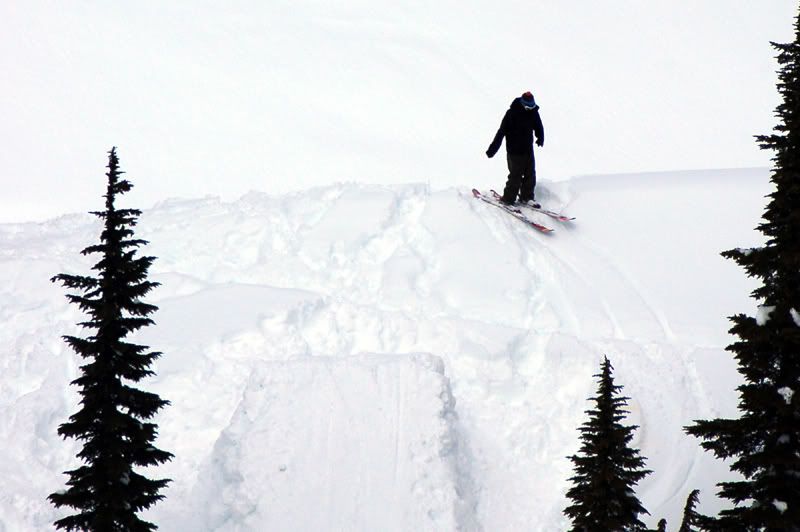
You can see one of the drops in Schmitz's last post in the background of your picture hehe. Also a very nice pic of you, that was the morning I went back to sleep >
 
Damnit, I don't know why you can't click them to make them bigger!

Well if you want to see them bigger just check out the pictures in my profile.

I suck at teh internets.
 
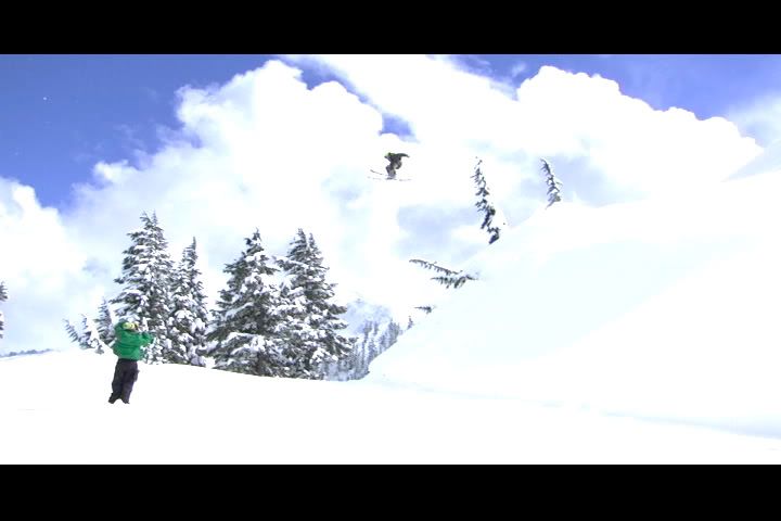
Some friends of mine took these shots at Alpental, maybe ~3 weeks back? This was taken near Chicken Chute to the left of Armstrong as your reaching the top (where people go ice climbing sometimes)

1.jpg


2.jpg


3.jpg


4.jpg

 
That chute has ripped on me. I got out lucky, I went back by myself and then it rips on me same place it ripped on me, first thought was ahh fuck. then 'wow your a fuckin idiot'
 
don't pretend like your good at math.

I know for a fact that my camera angle would not make it look smaller.

the equation you were looking for is this:

amplitude= [(quality of pipe)(pop of skis)^edge quality]/ice quantity
 
alpental 4/19

good morning

1208663374IMG_3088.JPG


lift lines were less than one hour

1208663436IMG_3090.JPG


scott and his noodles

1208663490IMG_3091.JPG


its hard to see, but check out how hard this guy cranked a turn. corey's couloir?

1208663547corey.JPG


piss pass sunbreak

1208663659piss_pass_hike.JPG


china wall scoping, drooling, but no skiing

1208663619china.JPG
 
I just looked at my skis and I got a fucking hugee scratch from that stupid one footed air bullshit, not quite a core shot luckily~
 
phil (esand) and i embarked on an earth day excursion.

this peak is east of stevens pass on the southside of highway 2. tops out around 6500'.

the view from highway 2:

1208922001IMG_3119.JPG


can you run in ski boots faster than a train?

1208922671IMG_3121.JPG


bushwacking thru the woods

1208923050IMG_3141.JPG


usfs roads most of the way up

1208923576IMG_3126.JPG


getting close to the peak reveals fun lines if there was better snow.

1208923320IMG_3129.JPG


and some gnar lines

1208923521IMG_3131.JPG


and some fun windloaded snow

1208923110IMG_3134.JPG


all systems go

1208922801IMG_3133.JPG


phil ready to head downhill finally

1208922871IMG_3136.JPG


phil making turns

1208922918IMG_3137.JPG


our tracks thru the avalanche path

1208922977IMG_3140.JPG


just east of stevens pass ski area. go to google maps and select "terrain" for viewtype....has most names of hilltops. but not Hilltop, Tacoma.
 
to be honest its not worth the long long journey to hike it or skin it. the bowl is sick but to much to get to it
 
Back
Top