Dude, how did you find the Maxim girls?
You are using an out of date browser. It may not display this or other websites correctly.
You should upgrade or use an alternative browser.
You should upgrade or use an alternative browser.
Google Earth Insaneness
- Thread starter almostaskier
- Start date
SkiingLlama
Member
someone find everest
Rich
Member
Just kidding!
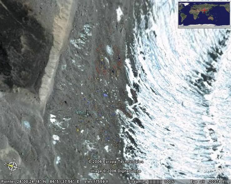
I think that this is base camp (coloured things are tents I think):
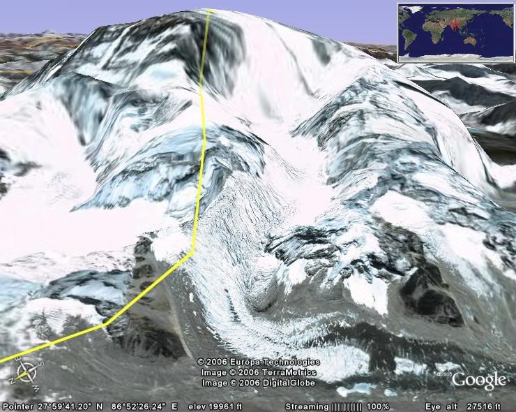
and this is everest itself (base camp located at the bottom of the glacier in the middle):
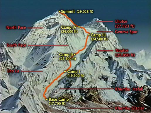
here's a map to help clear things up a little and compare with the photo above:
Now someone find me the Lighthouse Reef, and the famous Blue Hole (one of the most famous dives in the world) that is located within the reef.
I think that this is base camp (coloured things are tents I think):
and this is everest itself (base camp located at the bottom of the glacier in the middle):
here's a map to help clear things up a little and compare with the photo above:
Now someone find me the Lighthouse Reef, and the famous Blue Hole (one of the most famous dives in the world) that is located within the reef.
almostaskier
Active member
well so i know it's close to Belmoplan, but i see no blue hole...

almostaskier
Active member
how the hell did i miss THAT?...

almostaskier
Active member
ahahaha i hadn't figured. i was looking too little east though, in the waters that looked liek they could ahve been the blue hole.
But man, on google earth it's bland as heck.
But man, on google earth it's bland as heck.
almostaskier
Active member
do you mean the unknown soldier as seen in paris, or another one?
almostaskier
Active member

Here is the one in paris, it's under the arch.
almostaskier
Active member
gotcha.
almostaskier
Active member
There seem to be many... one in philly, one in DC...
almostaskier
Active member
So basically, i suck at my own game. i like this.

almostaskier
Active member
This is great... i find the spot, and my computer takes ten minutes to record the picture
Effing brilliant....

Effing brilliant....
almostaskier
Active member
wow i was the first to post it? incredible!
I was about to throw my computer out of the window.
Now, find me the Marseilles Skate Bowl.
I was about to throw my computer out of the window.
Now, find me the Marseilles Skate Bowl.

Poormansvault
Member

Poormansvault
Member
I am thinking...
almostaskier
Active member
is this it?

You can see the manual pads down by the pier reeeaaallllyyy well on google earth.
You can see the manual pads down by the pier reeeaaallllyyy well on google earth.
Poormansvault
Member
Kind of Complicated:
State's highest mountain and a ski area, in one shot, with the eye altitude below 24,000 feet. Ski area can't be on the highest mountain (No Stowe, for example, so VT is out even with Smuggs, because I told you)
State's highest mountain and a ski area, in one shot, with the eye altitude below 24,000 feet. Ski area can't be on the highest mountain (No Stowe, for example, so VT is out even with Smuggs, because I told you)
Poormansvault
Member
Oh, I didn't think I could be wrong. Whatever.
almostaskier
Active member
Yours is just further east. By the time my computer unfroze you had posted so...
almostaskier
Active member
Man, i need more ram or something...
![pyramids9im.jpg[IMG]](http://img46.imageshack.us/img46/9883/pyramids9im.jpg[IMG])
almostaskier
Active member
try again:

almostaskier
Active member
Find me the DC Mega Ramp in Temecula, California (i haven't found it yet, so a bit of help could be cool).
almostaskier
Active member
sorry it's Aguanga, california.
CameIToeJam
Active member
dc mega ramp bitches

now find me mount rushmore
now find me mount rushmore


skierdudeguy
Active member
thats sick!

GnarBurger
Active member
i give up
SkiingLlama
Member
impossable
find tiananmen square instead
find tiananmen square instead
Google Earth is satallite photo's, so it would just be a blue screen...