iLLbiLLy
Active member
Just thought I'd share my top three. I don't know how I'd get by without them. They are a critical part of my backcountry tool kit.
1: HillMap.com
This is an amazing tool to figure out your route prior to setting out on the trail head.

Feature Highlights:
* Side by Side Topo and sat imagery:
Just looking at Topo alone may lead you over cliffs or across sketch avi paths. Adding the Sat image gives you a bit more insight into the potential route (tip: you can enable cross-hairs in the settings to make it easier to match up the two)
* Slope analysis:
Both the "Custom Slope Analysis" and "Cal Topo Slope" overlays are really helpful to avoid avalanche terrain and find the easiest approach.
* Path routing and profile:
You can plot your estimated path and see its distance, vertical gain, etc.
There are tons of other features like NOAA Weather Radar and SNOTEL. The ones above are what I use the most though.
--------------------------
2: ViewRanger GPS (Android & iPhone)
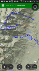
I've tried just about every GPS/Topo app out there and this is by far the best IMO. The App itself is free, but you have to pay to download the Topo Map. I think I paid 20$ for a lifetime subscription... Probably the best 20$ I've ever spent though.

Features:
* Offline Topo
* Route Tracking
* POI (point of interest) marking
* Can Sync to cloud (helpful if you lose or break your phone often as I do)
This one is really all about the map itself. The Topo map you purchase is the best I've been able to find anywhere. Most established trails and forest roads are marked. There is color coding to distinguish between private property, National Forest, Nation Park and BLM land (BLM is super helpful when you trying to find free camping on a road trip).
--------------------------
3: PYKL3 Radar (Android only)
A bit expensive but awesome if you want to get the raw radar data (I'm honestly still trying to learn how to read some of the images). Obviously requires data service, but I find I can get it to load much faster than trying to load a webpage to look at radar.
Cons: UI isn't amazing and the app itself is pricey...
--------------------------
Anyways, just thought I'd share.
If anyone else has any helpful apps/tools lets hear it.
1: HillMap.com
This is an amazing tool to figure out your route prior to setting out on the trail head.

Feature Highlights:
* Side by Side Topo and sat imagery:
Just looking at Topo alone may lead you over cliffs or across sketch avi paths. Adding the Sat image gives you a bit more insight into the potential route (tip: you can enable cross-hairs in the settings to make it easier to match up the two)
* Slope analysis:
Both the "Custom Slope Analysis" and "Cal Topo Slope" overlays are really helpful to avoid avalanche terrain and find the easiest approach.
* Path routing and profile:
You can plot your estimated path and see its distance, vertical gain, etc.
There are tons of other features like NOAA Weather Radar and SNOTEL. The ones above are what I use the most though.
--------------------------
2: ViewRanger GPS (Android & iPhone)
I've tried just about every GPS/Topo app out there and this is by far the best IMO. The App itself is free, but you have to pay to download the Topo Map. I think I paid 20$ for a lifetime subscription... Probably the best 20$ I've ever spent though.

Features:
* Offline Topo
* Route Tracking
* POI (point of interest) marking
* Can Sync to cloud (helpful if you lose or break your phone often as I do)
This one is really all about the map itself. The Topo map you purchase is the best I've been able to find anywhere. Most established trails and forest roads are marked. There is color coding to distinguish between private property, National Forest, Nation Park and BLM land (BLM is super helpful when you trying to find free camping on a road trip).
--------------------------
3: PYKL3 Radar (Android only)
A bit expensive but awesome if you want to get the raw radar data (I'm honestly still trying to learn how to read some of the images). Obviously requires data service, but I find I can get it to load much faster than trying to load a webpage to look at radar.
Cons: UI isn't amazing and the app itself is pricey...
--------------------------
Anyways, just thought I'd share.
If anyone else has any helpful apps/tools lets hear it.


