Bill.Nye
Active member
Forecast seem to be predicting with more and more certainty everyday that Mammoth/Tahoe's fate may be changing later this week.
From NOAA Reno
".LONG TERM...WEDNESDAY THROUGH SATURDAY...[/i]
VERY HIGH CONFIDENCE IN MAJOR PATTERN CHANGE LATE IN THE WEEK TO A
MILD, VERY WET PATTERN. ALL MODELS/ENSEMBLES IN EXCELLENT AGREEMENT
WITH PATTERN CHANGE AND HAVE EVEN TRENDED A LITTLE FURTHER SOUTH
THIS MORNING FOR THE THURSDAY SYSTEM. HAVE TRENDED POPS UP WED-THU
SOME, THEN JUST MINOR TWEAKS TO SNOW LEVELS/POPS THEREAFTER AS
FORECAST WAS IN GOOD SHAPE. ALSO INCREASED WINDS FOR THU-FRI.
INITIAL OVERRUNNING FOR WEDNESDAY AFTERNOON WILL BE CONFINED NORTH
OF PORTOLA-GERLACH. SNOW LEVELS ARE STILL AN ISSUE UP NORTH. WHILE
MODEL SOUNDINGS SUPPORT SNOW ALL DAY WITH COLD AIR DAMMING, SOUTH TO
NORTH SURFACE GRADIENT SUGGESTS MIXING OUT OF THE COLD AIR. MODELS
ALSO HINT THAT THIS MAY LAST INTO WED NIGHT, BUT I THINK THE DURATION
WILL BE SHORTER. OTHER CONCERN IS THE POTENTIAL FOR A SHORT PERIOD
OF FREEZING RAIN DURING THE TRANSITION IF A STRONG ENOUGH WARM
NOSE DEVELOPS. HAVE ADDED A SLIGHT CHANCE OF THAT TO THE GRIDS
WED. SNOW LEVELS ONCE IN THE WARM AIR WILL RISE TO 7000-9000 FEET
FROM NORTH TO SOUTH.
WARM AIR ADVECTION PRECIP TAPERS A BIT OVERNIGHT BEFORE THE MAIN
COLD FRONT APPROACHES. SNOW LEVELS WILL REMAIN HIGH, AND ONLY FALL A
COUPLE THOUSAND FEET AT THE TAIL END OF THE EVENT. SINCE MODELS HAVE
TRENDED FURTHER SOUTH, IT LOOKS LIKE A GOOD BET OF 1-3 INCHES OF
WATER IN THE SIERRA FROM TAHOE NORTH. MODELS ALSO SUGGEST STRONG
SHADOWING IN THE LEE, AND WHILE I DO BELIEVE IT WILL OCCUR IT WILL
BE PUSHED FURTHER DOWNSTREAM THAN NORMAL. WINDS OF 60+ KTS AT 700 MB
AND 75-90 KTS AT 500 SUPPORT THIS IDEA BASED ON PAST EXPERIENCE.
THEREFORE HAVE INCREASED POPS IN ADJACENT LEE SIDE VALLEYS ALONG THE
395 CORRIDOR NORTH OF MINDEN.
BREAK THU NIGHT ALTHOUGH SOME SHOWERS ARE LIKELY TO OCCUR AT TIMES
IN THE SIERRA. THEN WHAT MODELS SHOW TO BE THE BIGGEST STORM OF THE
PERIOD COMES IN FRI AFTERNOON-FRI NIGHT. WINDS AND RAIN ARE THE BIGGEST
THREATS WITH HIGH SNOW LEVELS NEAR 8000-9000 FEET AT ONSET. RAIN
COULD BE VERY HEAVY AS SHOWN BY GFS/GEM AND ENSEMBLES WITH
MODERATE TO HIGH CONFIDENCE IN THIS. TO ILLUSTRATE, GEFS 24 HR
PROBABILITY OF MORE THAN 2 INCHES IN THE SIERRA ENDING SATURDAY
MORNING IS OVER 60%. THIS IS AN IMPRESSIVE SIGNAL AT DAYS 2-3, BUT
THIS IS DAYS 6-7!!! SINCE POPS/SNOW LEVELS WERE HANDLED WELL,
INCREASED THE WINDS. BEFORE PRECIP STARTS, HIGH WINDS LIKELY IF
MODELS REMAIN CONSISTENT. EVEN WHEN SPILLOVER OCCURS ALONG 395
CORRIDOR, THE 70-80 KTS 700 MB WINDS AND STRONG SURFACE GRADIENT
WILL KEEP WINDS GOING EVEN WITH PRECIP.
BEHIND FRONTAL PASSAGE SNOW LEVELS SHOW DROP TO NEAR THE VALLEY
FLOORS BY SAT AFTERNOON WITH TEMPERATURES FALLING. PATTERN LOOKS TO
CONTINUE INTO EARLY NEXT WEEK BASED ON GEFS/GFS/CANADIAN. EC IS
DRIER, BUT GIVEN THE RIDGING EXPECTED ON THE EASTERN SIBERIA COAST
THE TELECONNECTIONS SUPPORT THE WETTER SOLUTION."
It looks like there is a lot of precip on the way but not too much cold air at first and then colder air over the weekend. If this means heavy base snow that's great because we have almost zero base here at mammoth (and I know you in Tahoe are in the same boat) so we need a base, but if it rains it could wash away the little snow we have.
Keep your fingers crossed.
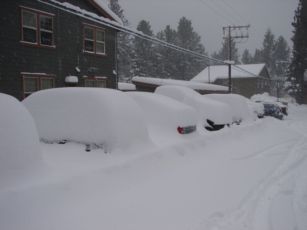
And wash your car, for good luck.
From NOAA Reno
".LONG TERM...WEDNESDAY THROUGH SATURDAY...[/i]
VERY HIGH CONFIDENCE IN MAJOR PATTERN CHANGE LATE IN THE WEEK TO A
MILD, VERY WET PATTERN. ALL MODELS/ENSEMBLES IN EXCELLENT AGREEMENT
WITH PATTERN CHANGE AND HAVE EVEN TRENDED A LITTLE FURTHER SOUTH
THIS MORNING FOR THE THURSDAY SYSTEM. HAVE TRENDED POPS UP WED-THU
SOME, THEN JUST MINOR TWEAKS TO SNOW LEVELS/POPS THEREAFTER AS
FORECAST WAS IN GOOD SHAPE. ALSO INCREASED WINDS FOR THU-FRI.
INITIAL OVERRUNNING FOR WEDNESDAY AFTERNOON WILL BE CONFINED NORTH
OF PORTOLA-GERLACH. SNOW LEVELS ARE STILL AN ISSUE UP NORTH. WHILE
MODEL SOUNDINGS SUPPORT SNOW ALL DAY WITH COLD AIR DAMMING, SOUTH TO
NORTH SURFACE GRADIENT SUGGESTS MIXING OUT OF THE COLD AIR. MODELS
ALSO HINT THAT THIS MAY LAST INTO WED NIGHT, BUT I THINK THE DURATION
WILL BE SHORTER. OTHER CONCERN IS THE POTENTIAL FOR A SHORT PERIOD
OF FREEZING RAIN DURING THE TRANSITION IF A STRONG ENOUGH WARM
NOSE DEVELOPS. HAVE ADDED A SLIGHT CHANCE OF THAT TO THE GRIDS
WED. SNOW LEVELS ONCE IN THE WARM AIR WILL RISE TO 7000-9000 FEET
FROM NORTH TO SOUTH.
WARM AIR ADVECTION PRECIP TAPERS A BIT OVERNIGHT BEFORE THE MAIN
COLD FRONT APPROACHES. SNOW LEVELS WILL REMAIN HIGH, AND ONLY FALL A
COUPLE THOUSAND FEET AT THE TAIL END OF THE EVENT. SINCE MODELS HAVE
TRENDED FURTHER SOUTH, IT LOOKS LIKE A GOOD BET OF 1-3 INCHES OF
WATER IN THE SIERRA FROM TAHOE NORTH. MODELS ALSO SUGGEST STRONG
SHADOWING IN THE LEE, AND WHILE I DO BELIEVE IT WILL OCCUR IT WILL
BE PUSHED FURTHER DOWNSTREAM THAN NORMAL. WINDS OF 60+ KTS AT 700 MB
AND 75-90 KTS AT 500 SUPPORT THIS IDEA BASED ON PAST EXPERIENCE.
THEREFORE HAVE INCREASED POPS IN ADJACENT LEE SIDE VALLEYS ALONG THE
395 CORRIDOR NORTH OF MINDEN.
BREAK THU NIGHT ALTHOUGH SOME SHOWERS ARE LIKELY TO OCCUR AT TIMES
IN THE SIERRA. THEN WHAT MODELS SHOW TO BE THE BIGGEST STORM OF THE
PERIOD COMES IN FRI AFTERNOON-FRI NIGHT. WINDS AND RAIN ARE THE BIGGEST
THREATS WITH HIGH SNOW LEVELS NEAR 8000-9000 FEET AT ONSET. RAIN
COULD BE VERY HEAVY AS SHOWN BY GFS/GEM AND ENSEMBLES WITH
MODERATE TO HIGH CONFIDENCE IN THIS. TO ILLUSTRATE, GEFS 24 HR
PROBABILITY OF MORE THAN 2 INCHES IN THE SIERRA ENDING SATURDAY
MORNING IS OVER 60%. THIS IS AN IMPRESSIVE SIGNAL AT DAYS 2-3, BUT
THIS IS DAYS 6-7!!! SINCE POPS/SNOW LEVELS WERE HANDLED WELL,
INCREASED THE WINDS. BEFORE PRECIP STARTS, HIGH WINDS LIKELY IF
MODELS REMAIN CONSISTENT. EVEN WHEN SPILLOVER OCCURS ALONG 395
CORRIDOR, THE 70-80 KTS 700 MB WINDS AND STRONG SURFACE GRADIENT
WILL KEEP WINDS GOING EVEN WITH PRECIP.
BEHIND FRONTAL PASSAGE SNOW LEVELS SHOW DROP TO NEAR THE VALLEY
FLOORS BY SAT AFTERNOON WITH TEMPERATURES FALLING. PATTERN LOOKS TO
CONTINUE INTO EARLY NEXT WEEK BASED ON GEFS/GFS/CANADIAN. EC IS
DRIER, BUT GIVEN THE RIDGING EXPECTED ON THE EASTERN SIBERIA COAST
THE TELECONNECTIONS SUPPORT THE WETTER SOLUTION."
It looks like there is a lot of precip on the way but not too much cold air at first and then colder air over the weekend. If this means heavy base snow that's great because we have almost zero base here at mammoth (and I know you in Tahoe are in the same boat) so we need a base, but if it rains it could wash away the little snow we have.
Keep your fingers crossed.
And wash your car, for good luck.

")