A

Whistler Topo/Satellite Run Map

  • Media owner Ahordal
  • Date added
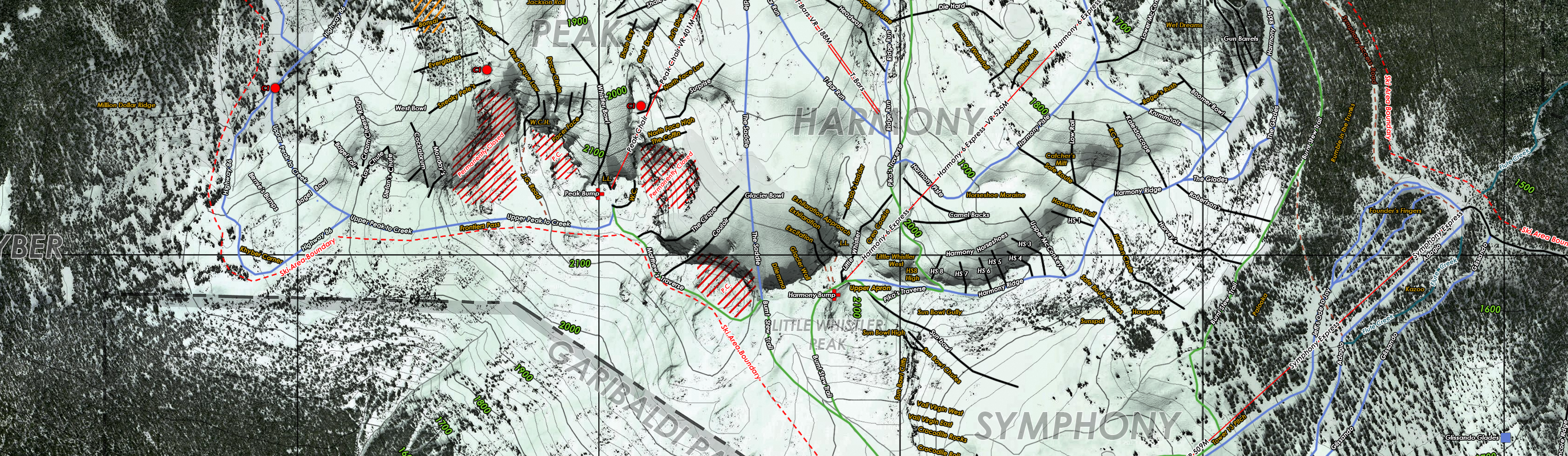
This is portion of a map I've been working on for the past 100 hours or so, with over 900 photoshop layers. Shows run names, patrol names, lifts, PC areas, cliff areas, reservoirs, etc. The map is accurate in terms of navigation, with UTM coordinates, WSG84 projection and magnetic declination.
Coincidentally, I'm looking for exact locations of Bean Sprout, Swan Dive and Daytona Bowl if anyone is aware.
 

Media information

Category
Art
Added by
Ahordal
Date added
View count
502
Comment count
1
Rating
0.00 star(s) 1 ratings

Share this media

Back
Top